•1 min read•from PetaPixel
Satellite Photos Show the Scale of This Week’s Historically Powerful Nor’Easter

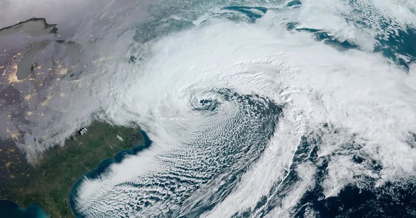
A historically powerful nor'easter winter storm has begun hammering the northeastern United States, causing widespread power outages and putting nearly 60 million Americans under winter storm warnings. As bad as the situation is on the ground, it looks downright incredible from space, as new NASA and NOAA satellite photos demonstrate.
Want to read more?
Check out the full article on the original site
Tagged with
#health and wellness
#nor'easter
#winter storm
#satellite photos
#Northeastern United States
#widespread power outages
#storm warnings
#NASA
#NOAA
#historically powerful
#scale
#Americans
#ground situation
#space view
#storm system
#dense cloud cover
#Atlantic Ocean
#Canada
#east coast
#severe weather